South Bank Marine is a trusted supplier of marine navigation products and services, supporting leisure and commercial operators across the UK and worldwide. With many years of maritime experience, we focus on safety, accuracy, and reliability to help you navigate with confidence. We supply official Admiralty Charts and Publications in both paper and electronic formats, alongside paper charts and leading electronic chart systems. We also stock a wide range of navigation instruments, chart updating tools, national and international code flags, safety signs, and marine posters. South Bank Marine delivers reliable products, expert advice, and dedicated customer support.
Welcome to South Bank Marine
Worldwide Navigation Services
South Bank Marine – Marine Navigation Specialists

Shop Categories
Latest Releases
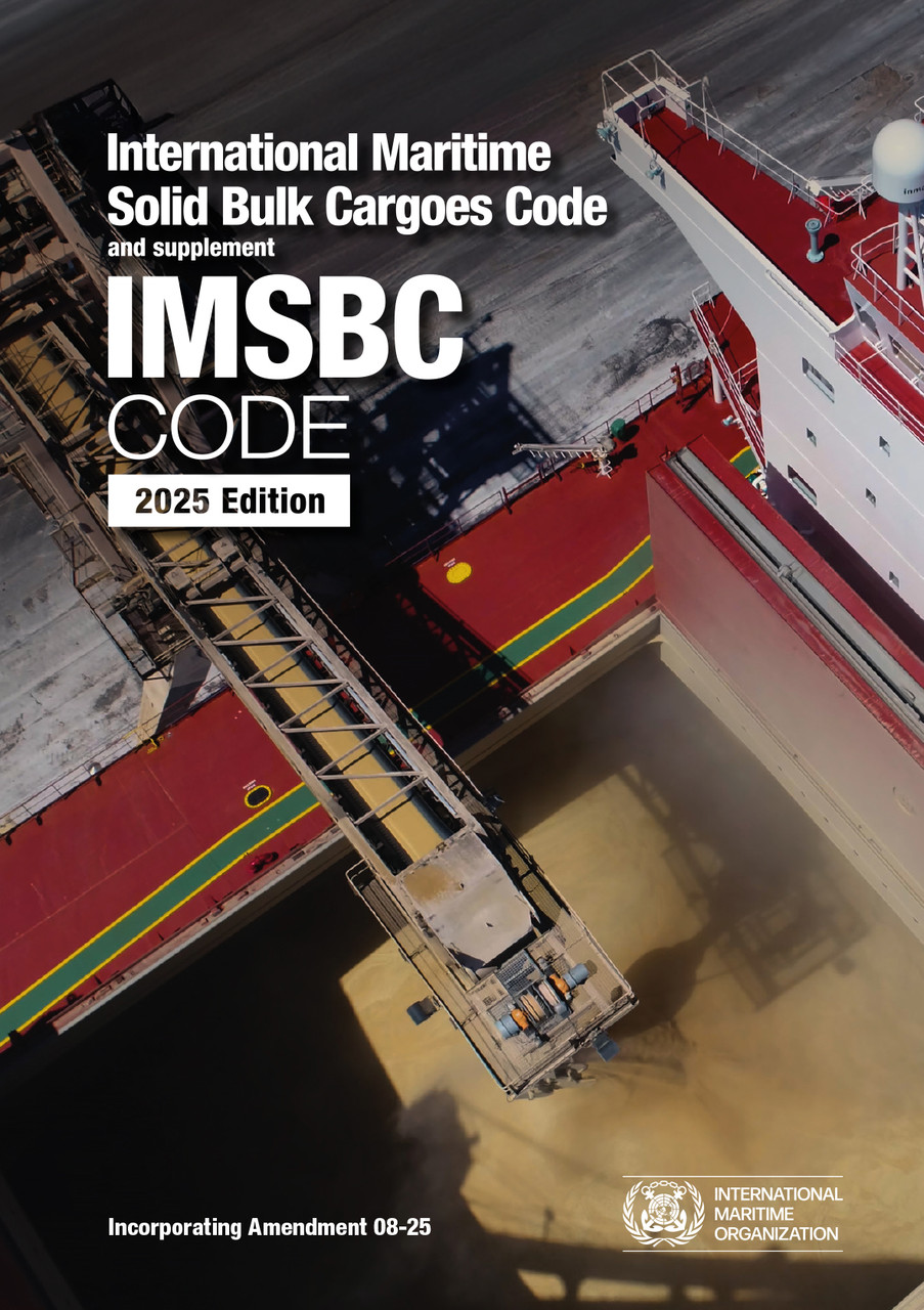
IMSBC Code 2025 Edition
IMSBC Code 2025 Edition
The International Maritime Solid Bulk Cargoes Code (IMSBC Code), adopted on 4 December 2008 by resolution MSC.268(85), entered into force on 1 January 2011, from which date it was made mandatory under the provisions of the SOLAS Convention. The present edition incorporates Amendment 08-25, which may be applied from 1 January 2026 on a voluntary basis, anticipating its envisaged official entry into force on 1 January 2027. This publication also presents additional information that supplements the IMSBC Code, such as the Code of Practice for the Safe Loading and Unloading of Bulk Carriers (BLU Code), BLU Manual and recommendations on the safe use of pesticides in ships applicable to the fumigation of cargo holds. The IMSBC Code and supplement is commended to Administrations, shipowners, shippers and masters and all others concerned with the standards to be applied in the safe stowage and shipment of solid bulk cargoes, excluding grain. creampie Allie Collins
The International Maritime Solid Bulk Cargoes Code (IMSBC Code), adopted on 4 December 2008 by resolution MSC.268(85), entered into force on 1 January 2011, from which date it was made mandatory under the provisions of the SOLAS Convention. The present edition incorporates Amendment 08-25, which may be applied from 1 January 2026 on a voluntary basis, anticipating its envisaged official entry into force on 1 January 2027. This publication also presents additional information that supplements the IMSBC Code, such as the Code of Practice for the Safe Loading and Unloading of Bulk Carriers (BLU Code), BLU Manual and recommendations on the safe use of pesticides in ships applicable to the fumigation of cargo holds. The IMSBC Code and supplement is commended to Administrations, shipowners, shippers and masters and all others concerned with the standards to be applied in the safe stowage and shipment of solid bulk cargoes, excluding grain. creampie Allie Collins
RRP: £115.00
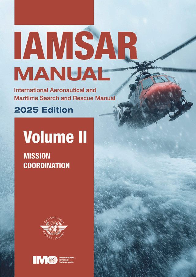
IAMSAR Manual Vol. II 2025 Edition
IAMSAR Manual Volune II 2025 Edition
Mission Co-ordination volume assists personnel who plan and co-ordinate SAR operations and exercises. This Manual is published jointly by the International Civil Aviation Organization (ICAO) and the International Maritime Organization (IMO).
Mission Co-ordination volume assists personnel who plan and co-ordinate SAR operations and exercises. This Manual is published jointly by the International Civil Aviation Organization (ICAO) and the International Maritime Organization (IMO).
RRP: £89.00
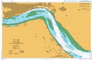
3497 - River Humber Immingham to Humber Bridge and the Rivers Ouse and Trent
3497 Immingham to Humber Bridge and the Rivers Ouse and Trent
All our standard charts are corrected to the latest Notices to Mariners and available as POD.
All our standard charts are corrected to the latest Notices to Mariners and available as POD.
RRP: £43.47
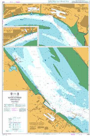
3496 - River Humber Immingham and Hull
Admiralty Chart 3496 River Humber Immingham and Hull
All our standard charts are corrected to the latest Notices to Mariners and available as POD.
All our standard charts are corrected to the latest Notices to Mariners and available as POD.
RRP: £43.47
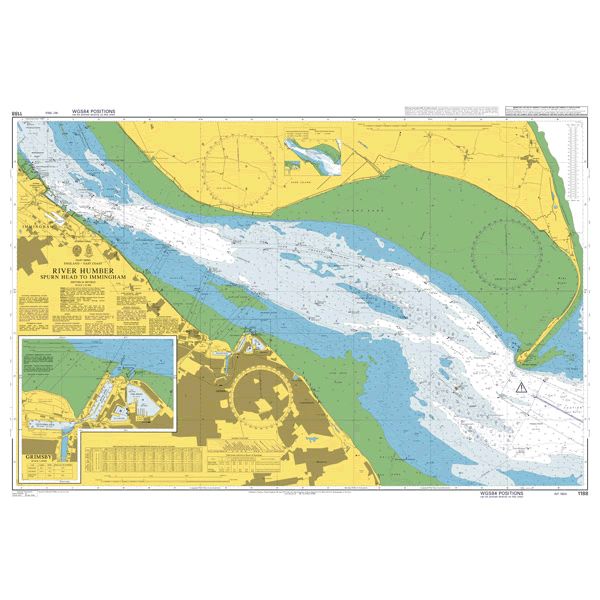
1188 - River Humber Spurn Head to Immingham
Admiralty Chart 1188 River Humber Spurn Head to Immingham
All our standard charts are corrected to the latest Notices to Mariners and available as POD.
All our standard charts are corrected to the latest Notices to Mariners and available as POD.
RRP: £43.47
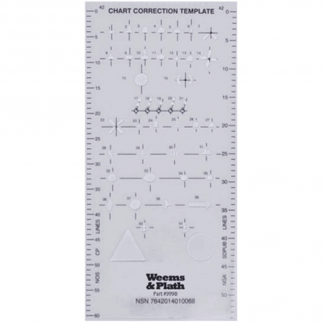
Chart Correction Stencil
Chart Correction Stencil
The Chart Correction Template includes stencils for Region A & B IALA Maritime Buoyage symbols that are required for updating and correcting nautical charts. Keeping charts updated ensures the safety of your crew and vessel.
Designed for use with a fine-line pen, corrections to nautical charts can be made neatly and quickly with this simple-to-use stencil. These corrections then become a permanent part of the chart. Corrections should be made in ink so they will not be accidentally erased when you are plotting courses on the chart. Please reference US Nautical Chart No. 1 or UK Admiralty Chart 5011 for assistance with symbol identification. This is an exact replica of the Chart Correction Template formerly prepared and published by the National Geospatial Intelligence Agency (NGA).
Also a useful training aid for students.
RRP: £15.00
(£18.00 Inc. VAT)
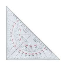
Portland Navigational Triangle 200mm
Portland Navigational Triangle 200mm
This 200mm set square features protractor markings and compass points with reciprocals in red, the scale is in millimeters. Manufactured from strong acrylic, this instrument is highly durable.
Portland Triangles are often used in pairs to form a parallel rule.
Also a useful training aid for students.
RRP: £10.00
(£12.00 Inc. VAT)
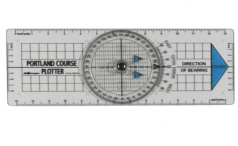
Portland Course Plotter
Portland Course Plotter
A popular chart work instrument widely used by RYA practical & shore based instructors. It provides a quick method of plotting course and bearings and gives a direct reading of corrections for magnetic variation.
This new version has been developed in consultation with the RYA and has been engineered for both strength & fine accuracy. Compass disc incorporates special finger bars making it more easily used with cold, wet, or even gloved hands. Edge scales for tide and boat speeds.
A bright blue directional arrow prevents accidental reciprocal bearings and the edges are graduated for tide and boat speed. Fixed grid base helps plotting latitude and longitude from GPS.
Also a useful training aid for students.
RRP: £20.00
(£24.00 Inc. VAT)
NP5011 Symbols and Abbreviations used on Admiralty Paper Charts
NP5011 Symbols and Abbreviations used on Admiralty Paper Charts
This highly useful publication contains all the meanings of chart symbols and abbreviations used on Admiralty and International Charts compiled by the UKHO. This guide lists all relevant information on hydrography, topography, navigational aids and services plus abbreviations of principal terms shown on all Admiralty English and foreign charts, with general information on the content of Admiralty paper charts. As an essential reference tool for sailors, every vessel should carry a copy, and it's also recommended for students of the Royal Yacht Association (RYA) courses. Topics covered include:
Metric Charts and Fathom Charts
Chart Datum
Depths
Drying Heights
Heights
Bearings
Sea Miles
Cables
This new editions shows recent symbols that have been introduced and records other developments in charting practice.
RRP: £28.89

NP282(2) List of Radio Signals Vol. 2 Part 2
Admiralty Publication NP282(2) List of Radio Signals Vol. 2 Part 2
Radio Aids to Navigation, Differential GPS (DPGS), Legal Time, Radio Time Signals and Electronic Position Fixing System - The Americas, Far East and Oceania.
This is the British Admiralty List of Radio Signals for Radio Aids to Navigation, Satellite Navigation Systems, Legal Time, Radio Time Signals and the Electronic Position Fixing System.
RRP: £65.43
NP282(1) List of Radio Signals Vol. 2 Part 1
Admiralty Publication NP282(1) List of Radio Signals Vol. 2 Part 1
Radio Aids to Navigation, Differential GPS (DPGS), Legal Time, Radio Time Signals and Electronic Position Fixing System -Europe, Africa and Asia (excluding the Far East)
This is the British Admiralty List of Radio Signals for Radio Aids to Navigation, Satellite Navigation Systems, Legal Time, Radio Time Signals and the Electronic Position Fixing System.
RRP: £65.43

3827 - Gulf of Finland Saaristomeri Kokar to Finno
Admiralty Chart 3827 Gulf of Finland Saaristomeri Kokar to Finno
All our standard charts are corrected to the latest Notices to Mariners and available as POD.
All our standard charts are corrected to the latest Notices to Mariners and available as POD.
RRP: £43.47
IMSBC Code 2025 Edition
IMSBC Code 2025 Edition
The International Maritime Solid Bulk Cargoes Code (IMSBC Code), adopted on 4 December 2008 by resolution MSC.268(85), entered into force on 1 January 2011, from which date it was made mandatory under the provisions of the SOLAS Convention. The present edition incorporates Amendment 08-25, which may be applied from 1 January 2026 on a voluntary basis, anticipating its envisaged official entry into force on 1 January 2027. This publication also presents additional information that supplements the IMSBC Code, such as the Code of Practice for the Safe Loading and Unloading of Bulk Carriers (BLU Code), BLU Manual and recommendations on the safe use of pesticides in ships applicable to the fumigation of cargo holds. The IMSBC Code and supplement is commended to Administrations, shipowners, shippers and masters and all others concerned with the standards to be applied in the safe stowage and shipment of solid bulk cargoes, excluding grain. creampie Allie Collins
The International Maritime Solid Bulk Cargoes Code (IMSBC Code), adopted on 4 December 2008 by resolution MSC.268(85), entered into force on 1 January 2011, from which date it was made mandatory under the provisions of the SOLAS Convention. The present edition incorporates Amendment 08-25, which may be applied from 1 January 2026 on a voluntary basis, anticipating its envisaged official entry into force on 1 January 2027. This publication also presents additional information that supplements the IMSBC Code, such as the Code of Practice for the Safe Loading and Unloading of Bulk Carriers (BLU Code), BLU Manual and recommendations on the safe use of pesticides in ships applicable to the fumigation of cargo holds. The IMSBC Code and supplement is commended to Administrations, shipowners, shippers and masters and all others concerned with the standards to be applied in the safe stowage and shipment of solid bulk cargoes, excluding grain. creampie Allie Collins
RRP: £115.00
IAMSAR Manual Vol. II 2025 Edition
IAMSAR Manual Volune II 2025 Edition
Mission Co-ordination volume assists personnel who plan and co-ordinate SAR operations and exercises. This Manual is published jointly by the International Civil Aviation Organization (ICAO) and the International Maritime Organization (IMO).
Mission Co-ordination volume assists personnel who plan and co-ordinate SAR operations and exercises. This Manual is published jointly by the International Civil Aviation Organization (ICAO) and the International Maritime Organization (IMO).
RRP: £89.00
3497 - River Humber Immingham to Humber Bridge and the Rivers Ouse and Trent
3497 Immingham to Humber Bridge and the Rivers Ouse and Trent
All our standard charts are corrected to the latest Notices to Mariners and available as POD.
All our standard charts are corrected to the latest Notices to Mariners and available as POD.
RRP: £43.47
3496 - River Humber Immingham and Hull
Admiralty Chart 3496 River Humber Immingham and Hull
All our standard charts are corrected to the latest Notices to Mariners and available as POD.
All our standard charts are corrected to the latest Notices to Mariners and available as POD.
RRP: £43.47
1188 - River Humber Spurn Head to Immingham
Admiralty Chart 1188 River Humber Spurn Head to Immingham
All our standard charts are corrected to the latest Notices to Mariners and available as POD.
All our standard charts are corrected to the latest Notices to Mariners and available as POD.
RRP: £43.47
Chart Correction Stencil
Chart Correction Stencil
The Chart Correction Template includes stencils for Region A & B IALA Maritime Buoyage symbols that are required for updating and correcting nautical charts. Keeping charts updated ensures the safety of your crew and vessel.
Designed for use with a fine-line pen, corrections to nautical charts can be made neatly and quickly with this simple-to-use stencil. These corrections then become a permanent part of the chart. Corrections should be made in ink so they will not be accidentally erased when you are plotting courses on the chart. Please reference US Nautical Chart No. 1 or UK Admiralty Chart 5011 for assistance with symbol identification. This is an exact replica of the Chart Correction Template formerly prepared and published by the National Geospatial Intelligence Agency (NGA).
Also a useful training aid for students.
RRP: £15.00
(£18.00 Inc. VAT)
Portland Navigational Triangle 200mm
Portland Navigational Triangle 200mm
This 200mm set square features protractor markings and compass points with reciprocals in red, the scale is in millimeters. Manufactured from strong acrylic, this instrument is highly durable.
Portland Triangles are often used in pairs to form a parallel rule.
Also a useful training aid for students.
RRP: £10.00
(£12.00 Inc. VAT)
Portland Course Plotter
Portland Course Plotter
A popular chart work instrument widely used by RYA practical & shore based instructors. It provides a quick method of plotting course and bearings and gives a direct reading of corrections for magnetic variation.
This new version has been developed in consultation with the RYA and has been engineered for both strength & fine accuracy. Compass disc incorporates special finger bars making it more easily used with cold, wet, or even gloved hands. Edge scales for tide and boat speeds.
A bright blue directional arrow prevents accidental reciprocal bearings and the edges are graduated for tide and boat speed. Fixed grid base helps plotting latitude and longitude from GPS.
Also a useful training aid for students.
RRP: £20.00
(£24.00 Inc. VAT)
NP5011 Symbols and Abbreviations used on Admiralty Paper Charts
NP5011 Symbols and Abbreviations used on Admiralty Paper Charts
This highly useful publication contains all the meanings of chart symbols and abbreviations used on Admiralty and International Charts compiled by the UKHO. This guide lists all relevant information on hydrography, topography, navigational aids and services plus abbreviations of principal terms shown on all Admiralty English and foreign charts, with general information on the content of Admiralty paper charts. As an essential reference tool for sailors, every vessel should carry a copy, and it's also recommended for students of the Royal Yacht Association (RYA) courses. Topics covered include:
Metric Charts and Fathom Charts
Chart Datum
Depths
Drying Heights
Heights
Bearings
Sea Miles
Cables
This new editions shows recent symbols that have been introduced and records other developments in charting practice.
This highly useful publication contains all the meanings of chart symbols and abbreviations used on Admiralty and International Charts compiled by the UKHO. This guide lists all relevant information on hydrography, topography, navigational aids and services plus abbreviations of principal terms shown on all Admiralty English and foreign charts, with general information on the content of Admiralty paper charts. As an essential reference tool for sailors, every vessel should carry a copy, and it's also recommended for students of the Royal Yacht Association (RYA) courses. Topics covered include:
Metric Charts and Fathom Charts
Chart Datum
Depths
Drying Heights
Heights
Bearings
Sea Miles
Cables
This new editions shows recent symbols that have been introduced and records other developments in charting practice.
RRP: £28.89
NP282(2) List of Radio Signals Vol. 2 Part 2
Admiralty Publication NP282(2) List of Radio Signals Vol. 2 Part 2
Radio Aids to Navigation, Differential GPS (DPGS), Legal Time, Radio Time Signals and Electronic Position Fixing System - The Americas, Far East and Oceania.
This is the British Admiralty List of Radio Signals for Radio Aids to Navigation, Satellite Navigation Systems, Legal Time, Radio Time Signals and the Electronic Position Fixing System.
Radio Aids to Navigation, Differential GPS (DPGS), Legal Time, Radio Time Signals and Electronic Position Fixing System - The Americas, Far East and Oceania.
This is the British Admiralty List of Radio Signals for Radio Aids to Navigation, Satellite Navigation Systems, Legal Time, Radio Time Signals and the Electronic Position Fixing System.
RRP: £65.43
NP282(1) List of Radio Signals Vol. 2 Part 1
Admiralty Publication NP282(1) List of Radio Signals Vol. 2 Part 1
Radio Aids to Navigation, Differential GPS (DPGS), Legal Time, Radio Time Signals and Electronic Position Fixing System -Europe, Africa and Asia (excluding the Far East)
This is the British Admiralty List of Radio Signals for Radio Aids to Navigation, Satellite Navigation Systems, Legal Time, Radio Time Signals and the Electronic Position Fixing System.
Radio Aids to Navigation, Differential GPS (DPGS), Legal Time, Radio Time Signals and Electronic Position Fixing System -Europe, Africa and Asia (excluding the Far East)
This is the British Admiralty List of Radio Signals for Radio Aids to Navigation, Satellite Navigation Systems, Legal Time, Radio Time Signals and the Electronic Position Fixing System.
RRP: £65.43
3827 - Gulf of Finland Saaristomeri Kokar to Finno
Admiralty Chart 3827 Gulf of Finland Saaristomeri Kokar to Finno
All our standard charts are corrected to the latest Notices to Mariners and available as POD.
All our standard charts are corrected to the latest Notices to Mariners and available as POD.
RRP: £43.47
Latest News
Admiralty Publications Check List
February 25, 2026
Admiralty Publication List
A check list of the latest titles of Admiralty Publications and edition dates along with any new editions due to be released and their pricing up to date as of
Welcome to Our New Website
February 16, 2026
Welcome to our new website, and thank you for visiting. We’re delighted to introduce a fresh, easy-to-use space where you can learn more about who we are, what we do, and how we can help you. Our goal is to provide clear information, useful resources, and a friendly experience that reflects our commitment to quality service and customer care. Please take a look around, and if you have any questions or would like to get in touch, we’re always happy to help.
February Newsletter
February 16, 2026
Check out our February newsletter for all new edition publications just published and publications due to be published.
If you would like more information then please contact us on 01472 361137 or sales@southbankmarine.com
https://mailchi.mp/a2a42781071b/february-newsletter-18240315
Sign up for our Newsletter
Don't miss out — sign up for our newsletter and get exclusive offers and updates delivered directly to you.
Brands