-
×
 1118 - Spain North West Coast Ria de Ferrol
1 × £37.80
1118 - Spain North West Coast Ria de Ferrol
1 × £37.80
Subtotal: £37.80
 1118 - Spain North West Coast Ria de Ferrol
1 × £37.80
1118 - Spain North West Coast Ria de Ferrol
1 × £37.80 Subtotal: £37.80
£37.80
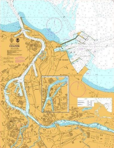
In StockBaltic Sea – Poland, Gdansk
Admiralty Chart 2637 Baltic Sea Poland Gdansk
All our standard charts are corrected to the latest Notices to Mariners and available as POD. Please contact us if you would prefer this in POD (print on demand) format.
| Weight | 0.5 kg |
|---|---|
| Dimensions | 88 cm |
| Edition Date | 02/11/2023 |
| Publisher | UKHO |
| Author | Admiralty |
Spain – North Coast, Puertos de Bermeo and Mundaca
Spain – North Coast, Santander
Spain – North Coast, Gijon
Ports on the Western part of the North Coast of Spain
France – North Coast, Approaches to Cherbourg, Cap de la Hague to Pointe de Barfleur
Bay of Biscay
