-
×
 1164 - Hartland Point to Ilfracombe including Lundy
1 × £31.50
1164 - Hartland Point to Ilfracombe including Lundy
1 × £31.50 -
×
 1244 - Fiji Islands Ovalau Levuka Harbour
1 × £31.50
1244 - Fiji Islands Ovalau Levuka Harbour
1 × £31.50 -
×
 1156 - Trevose Head to Hartland Point
1 × £31.50
1156 - Trevose Head to Hartland Point
1 × £31.50 -
×
 39 - Gulf of Kachchh to Sonmiani Bay
1 × £31.50
39 - Gulf of Kachchh to Sonmiani Bay
1 × £31.50 -
×
 NP251 Tidal Stream Atlas North Sea Southern Part
2 × £20.07
NP251 Tidal Stream Atlas North Sea Southern Part
2 × £20.07 -
×
 120 - Westerschelde Vlissingen Oost Nauw van Baalhoek
1 × £31.50
120 - Westerschelde Vlissingen Oost Nauw van Baalhoek
1 × £31.50 -
×
 NP48 Admiralty Sailing Directions Mediterranean Pilot Vol. 4
1 × £75.96
NP48 Admiralty Sailing Directions Mediterranean Pilot Vol. 4
1 × £75.96 -
×
 255 - Eastern Approaches to Jamaica
1 × £31.50
255 - Eastern Approaches to Jamaica
1 × £31.50 -
×
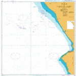 307 - Angola Cabeca da Cobra to Cabo Ledo
1 × £31.50
307 - Angola Cabeca da Cobra to Cabo Ledo
1 × £31.50 -
×
 3854 - Freeport to Calcasieu Pass
1 × £31.50
3854 - Freeport to Calcasieu Pass
1 × £31.50 -
×
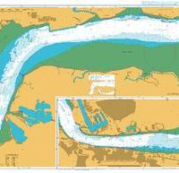 1186 - England East Coast River Thames Canvey Island to Tilbury
1 × £31.50
1186 - England East Coast River Thames Canvey Island to Tilbury
1 × £31.50 -
×
 1229 - Khaw 'Abd Allah, Hadd Warbah to Athan Shoal
1 × £31.50
1229 - Khaw 'Abd Allah, Hadd Warbah to Athan Shoal
1 × £31.50 -
×
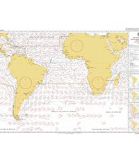 5125(2) - Routeing Chart South Atlantic Ocean - February
2 × £17.73
5125(2) - Routeing Chart South Atlantic Ocean - February
2 × £17.73 -
×
 Rule of the Road Flip Cards
1 × £10.00
Rule of the Road Flip Cards
1 × £10.00 -
×
 55 - Laguna de Chiriqui
1 × £31.50
55 - Laguna de Chiriqui
1 × £31.50 -
×
 346 - China Zhu Jiang Nizhou Tou to Huangpu
1 × £31.50
346 - China Zhu Jiang Nizhou Tou to Huangpu
1 × £31.50 -
×
 1215 - Plans on the Coast of Angola
1 × £31.50
1215 - Plans on the Coast of Angola
1 × £31.50 -
×
 27 - Iran Bushehr
1 × £31.50
27 - Iran Bushehr
1 × £31.50 -
×
 1182 - South Wales Barry and Cardiff Roads with Approaches
1 × £31.50
1182 - South Wales Barry and Cardiff Roads with Approaches
1 × £31.50 -
×
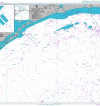
 264 - Africa East Coast Gulf of Aden Approaches to Djibouti
1 × £31.50
264 - Africa East Coast Gulf of Aden Approaches to Djibouti
1 × £31.50 -
×
 979 - Indonesia Jawa North Coast Selat Surabaya Sheet 3
1 × £31.50
979 - Indonesia Jawa North Coast Selat Surabaya Sheet 3
1 × £31.50 -
×
 GMDSS Manual 2024 Edition
1 × £135.00
GMDSS Manual 2024 Edition
1 × £135.00 -
×
 1187 - Outer Silver Pit
1 × £31.50
1187 - Outer Silver Pit
1 × £31.50 -
×
2641 - China Bo Hai Jingtang Gangqu
1 × £31.50
-
×
 NP259 Tidal Stream Atlas Irish Sea Eastern Part
1 × £20.07
NP259 Tidal Stream Atlas Irish Sea Eastern Part
1 × £20.07 -
×
 NP350(1) Admiralty Distance Tables Atlantic Ocean Vol 1
1 × £39.60
NP350(1) Admiralty Distance Tables Atlantic Ocean Vol 1
1 × £39.60 -
×
 3990 - Gulf of Tongking (Northern sheet)
1 × £31.50
3990 - Gulf of Tongking (Northern sheet)
1 × £31.50 -
×
5124(6) - Routeing Chart North Atlantic Ocean - June
1 × £17.73
-
×
 256 - Western Approaches to Jamaica
1 × £31.50
256 - Western Approaches to Jamaica
1 × £31.50 -
×
 2416 - China East China Sea Luoyuan Wan
1 × £31.50
2416 - China East China Sea Luoyuan Wan
1 × £31.50
Subtotal: £1,066.96