-
×
 Imray Chart C51 Cardigan Bay
1 × £28.95
Imray Chart C51 Cardigan Bay
1 × £28.95
Subtotal: £28.95
 Imray Chart C51 Cardigan Bay
1 × £28.95
Imray Chart C51 Cardigan Bay
1 × £28.95 Subtotal: £28.95
£28.95
In Stock1 in stock (can be backordered)
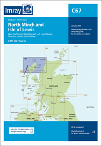
Imray C67 North Minch and Isle of Lewis
Plans included:
Loch Inchard (Kinlochbervie) (1:12,500)
Loch Inver (1:15,000)
Ullapool (1:10,000)
Stornoway Harbour (1:15,000)
Loch Carloway (1:20,000)
In this 2022 edition the latest depth surveys have been included. The chart specification has been improved to show coloured light flashes. There has been general updating throughout.
| Weight | 0.5 kg |
|---|---|
| Dimensions | 30 × 25 × 1 cm |
| Edition Date | Mar-22 |
| Scale | 1:155, 000 WGS 84 |
