-
×
 Imray Chart C26 IJmuiden to Die Elbe
1 × £28.95
Imray Chart C26 IJmuiden to Die Elbe
1 × £28.95
Subtotal: £28.95
 Imray Chart C26 IJmuiden to Die Elbe
1 × £28.95
Imray Chart C26 IJmuiden to Die Elbe
1 × £28.95 Subtotal: £28.95
£28.95
In StockAvailable on back-order
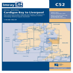
Scale: 1:145 000 WGS84
Wales to the East Coast of Ireland
Plans included:
Conwy (1:30 000)
Conwy Bay (1:60 000)
Holyhead (1:25 000)
The Swellies (1:15 000)
Port Dinorwic (1:15 000)
Caernarfon (1:15 000)
Menai Strait (1:60 000)
Porth Dinll?en (1:17 500)
Abersoch (1:15 000)
Pwllheli (1:15 000)
Porthmadog (1:10 000)
Mochras Lagoon (1:15 000)
Barmouth (1:30 000)
On this 2015 edition the chart has been fully updated throughout including revised depths at Holyhead Harbour and off The Skerries. Revised buoyage in the entrance to Barmouth and Caernarfon Bar are also shown.
| Weight | 0.5 kg |
|---|---|
| Dimensions | 30 × 25 × 1 cm |
| Edition Date | Sep-15 |
| Scale | 1:145 000 WGS84 |
