
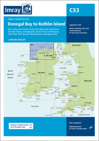
Imray Chart C53 Donegal Bay to Rathlin Island
£28.95
In Stock1 in stock (can be backordered)

Description
Imray Chart C53 Donegal Bay to Rathlin Island
Plans:
Portrush
Lough Swilly
Mulroy Bay
Sheep Haven
Gweedore Harbour & Approaches
Sound of Aran & Burtonport
Teelin Harbour
Killybegs Harbour
Mullaghmore Bay
2021 edition updated throughout.
Additional information
| Weight | 0.5 kg |
|---|---|
| Dimensions | 30 × 25 × 1 cm |
| Edition Date | Mar-22 |
| Scale | 1:200 000 WGS 84 |
Related Products
-

Western English Channel Passage
£28.95 -
Eastern English Channel Passage
£28.95 -
£28.95
-
£28.95
-
Thames Estuary
£28.95 -
£28.95